At a Glance
- CoMapeo Abare launched last year and continues to evolve through close collaboration with frontline communities
- In 2026, the team is focused on expanding access through iOS, improving stability, and strengthening desktop workflows for richer outputs
- Our approach combines insights from community relationships with data and observability to improve the platform at scale
- CoMapeo is part of a broader vision: Infrastructure that supports Indigenous territorial protection and community-led data sovereignty
- We launched our Intro to CoMapeo webinar series! Register here
A Big Year for CoMapeo
Across forests, rivers, and coastlines around the world, frontline communities are documenting environmental change and defending the territories they depend on. The knowledge they gather — about deforestation, illegal extraction, water quality, and ecosystem health — can play a critical role in protecting biodiversity and supporting territorial defense.
But turning that knowledge into organized, shareable information isn’t always easy. Communities often work in remote environments with limited connectivity, and many tools available today aren’t designed for their realities.
That challenge is one of the reasons CoMapeo exists.
CoMapeo has been developed in close collaboration with frontline communities, whose knowledge and experience have shaped the tool from the beginning. At Awana Digital, our interdisciplinary team of designers, technologists, anthropologists and human geographers works alongside partners to build technology that reflects real-world needs.
Last year marked a major milestone for our team with the launch of CoMapeo Abare, the newest evolution of the CoMapeo platform. Developed in collaboration with partners working on the frontlines of environmental protection, Abare helps communities document what’s happening in their territories and organize information that can support monitoring, advocacy, and protection efforts.
But launching Abare was only the beginning. Like any tool designed for real-world use, its development continues through collaboration with the people using it.
Earlier this year, we gathered for a retreat to reflect on what we’ve learned since the release of Abare — and to shape the next phase of development, including expanding CoMapeo to iOS and strengthening the platform for a growing global user base.
Our Long-Term Vision
Our work with CoMapeo is part of a broader effort to support communities working to defend their territories and protect the ecosystems they depend on. Their leadership is increasingly recognized as essential to protecting biodiversity and confronting the climate crisis.
At the same time, environmental defenders face growing threats. As our Executive Director, Emily Jacobi, reflected in her 2025 year-in-review, the work of territorial defense is becoming both more urgent and more visible as communities continue organizing to protect the ecosystems they care for against increasing threats.
We have invested in scaling CoMapeo as part of a broader vision: supporting communities to use the tool to protect 100 million hectares of climate-critical territory over the next few years.
Reaching that goal will require strong partnerships, shared knowledge, and tools that work in real-world conditions. For our team, that means building technology with communities, not just for them. Our work is grounded in the belief that communities must be able to gather, manage, and interpret their own data in order to effectively protect their lands.
The experiences, insights, and priorities of the people using CoMapeo play a central role in shaping how the platform evolves. Indigenous partners have used CoMapeo to map their territories for land rights cases, monitor illegal activity within their lands, document biodiversity, and support many other projects related to territorial defense and environmental conservation.
Increasingly, we think of CoMapeo not just as a tool, but as infrastructure for Indigenous territorial protection.
It’s a platform where communities are the agents of combining new technologies with traditional ecological knowledge — in ways that strengthen their ability to protect their lands and ensure that data creates value for communities, rather than extracting it.
Behind the Scenes: How the CoMapeo Team Shapes the Roadmap
Earlier this year, members of our team — a mix of program and product staff — gathered for a retreat to reflect on what we’ve learned since the release of Abare and to shape the next phase of development. A key goal was to share stories and feedback from colleagues working closely with partners, bringing real experiences from the field into the conversation. Bringing those perspectives together with our technical team helped inform the roadmap and ensured everyone left with a shared understanding of the priorities guiding the year ahead.
These conversations reflect a core part of how CoMapeo evolves.
As Product Manager Ximena Becerra shared during the retreat, our approach to product development is grounded in real-world relationships with communities, and increasingly strengthened by the use of data and observability to help us improve the platform at scale.
At the same time, as CoMapeo grows from hundreds of users to thousands, we are investing in better ways to understand how the platform is used at scale. To date, much of what we’ve learned has come from direct conversations with partners and communities. As we grow, we are developing approaches to observability — using data to complement these relationships and provide insight into how the app is being used, where challenges arise, and how we can improve reliability and performance over time.
This work is guided by a strong commitment to privacy and non-extractive design. We do not track or identify users by default, and we do not access the data communities collect. Instead, we focus on gathering anonymized, consent-based insights that help us improve the platform while ensuring communities retain control over their information.
This approach is reflected in how we understand the development process itself. As Mauve Signweaver, Lead Backend Developer, explains:
“What’s unique about this work is that it’s completely person-first. The needs come from people on the ground — communities define what’s important, what’s missing, and what would actually be useful. Then developers help figure out the details of how to make it work on a technical level and which things are more or less feasible. This can be different from other tech projects where the tech people are in charge and time gets spent on looking at metrics and R&D instead of how the technology affects the people that use it.”
Another distinctive part of the process is collaboration across our codesign team. Developers participate directly in discussions about product direction alongside colleagues who work closely with partners, as well as team members focused on design and product. This interdisciplinary approach helps ensure that development decisions are informed by the real-world contexts and priorities of the communities who use CoMapeo.
2026 Priorities
During the retreat, we aligned on four key priorities for the year ahead:
- iOS release — expanding access to CoMapeo across devices and making the platform more widely available
- Stability — improving reliability, fixing bugs, and strengthening performance as usage grows
- Richer outputs — strengthening desktop workflows so communities can turn data into reports and actionable insight
- Observability — improving how we understand usage and impact at scale, combining community insights with data to strengthen the platform
Expanding Access: iOS Release
One of the most significant steps forward for CoMapeo this year is the upcoming iOS release. Expanding beyond Android will make the platform accessible to more communities and partners, allowing them to use CoMapeo across a wider range of devices in the field. This is a key step toward increasing adoption and ensuring the tool can meet the needs of a growing and diverse user base.
Improving the Core Experience
We are continuing to improve Abare for end users by refining workflows and simplifying the user experience so communities can more easily collect and organize information.
Improving our Observability
We are strengthening how we understand how CoMapeo is used as the platform grows — combining insights from our work with partners with data that helps us identify what’s working, where challenges arise, and how to improve the platform over time.
Strengthening Outputs and Workflows
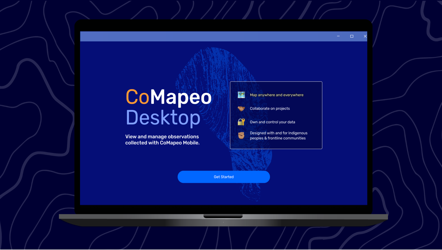
Another priority is supporting richer outputs as part of the desktop workflow. Communities often collect valuable information about environmental conditions and threats to their territories, and CoMapeo Desktop plays an important role in helping organize that information into reports and other outputs that support advocacy, environmental protection efforts, and community decision-making.
Part of this workflow includes tools beyond the mobile app. While observations are often collected in the field using CoMapeo Mobile, the CoMapeo Desktop application allows us to review, organize, and work with that information on a computer. This makes it easier for communities and partner organizations to analyze observations, prepare reports, and use the data they collect to support territorial defense efforts.
CoMapeo is an open-source platform designed to work even in remote environments with limited connectivity. Built on a decentralized, peer-to-peer database, data is shared between trusted devices within a project rather than stored in a centralized system. This allows communities to maintain greater control over the information they collect.
This extends to how the technology itself is designed. As Mauve adds:
“What makes CoMapeo different is that it’s not extractive and it’s built to be resilient. All of the data is held in the community. So long as somebody has a copy, it won’t get lost.”
We are also preparing for an upcoming iOS release, which will expand access to the platform and make it easier for communities to use CoMapeo across devices while working in the field.
.png)
What Comes Next for CoMapeo
Looking ahead, our team will continue improving CoMapeo Abare and expanding the platform’s capabilities based on what we’re learning from partners using the tool.
This includes the upcoming iOS release — a major step in expanding access to CoMapeo — along with continued improvements to user workflows, and new ways for communities to generate meaningful outputs from the information they collect.
As more communities adopt CoMapeo, their experiences will continue shaping how the platform evolves.
All of this work contributes to the broader goal of supporting communities working to protect 100 million hectares of land. As CoMapeo grows, we also aim to ensure that the information communities gather is increasingly recognized by authorities, institutions, and conservation organizations — helping local knowledge play a stronger role in decision-making that affects their lands.
As CoMapeo continues to evolve, our goal remains the same: to support the people already doing the work of protecting their territories. By building tools that reflect their knowledge, priorities, and leadership, we hope to make it easier for communities to document what is happening on their lands — and to turn that knowledge into action.
Learn More and Get Involved
There are several ways to learn more about CoMapeo and support this work.
Join a CoMapeo 101 Webinar
Register here for our upcoming sessions
Spread the Word
If you care about environmental protection and community-led monitoring, sharing CoMapeo with your networks helps more people learn about the tool
Explore the Tool
Organizations working in environmental monitoring and territorial defense can learn more about how CoMapeo may support their work.
Support the Work
Help expand the reach and continued development of tools that support frontline communities protecting their territories.