Editor's note: On November 5, Awana Digital will launch Mapping for Legal Impact: How Indigenous and Local Communities Use Maps to Assert Rights and Defend Territory. In this essay, report coauthor Aliya Ryan reflects on the power of community mapping to communicate Indigenous relationships to land and support legal strategies for territorial defense.
Join us for the virtual launch to explore these themes with Indigenous leaders, legal advocates, and the report's authors. Register for the November 5 event
Three years ago I had the privilege of listening to Kibet, an Ogiek singer from Mount Elgon, sitting high on the sacred mountain, with a view to the summit, during a gathering of East African Indigenous Earth defenders. Kibet sang about his homeland, the forest and moorland, and how it is filled with stories told by his ancestors, passed down through the generations by their clan system. All the important places within this land were visited by the Ogiek during their recent mapping project – Boititap Korenyo, the Wealth of our Lands – such as the caves they share with elephants and meadows of spring flowers which feed the honey bees and the bamboo forests rich in medicinal plants.
I challenge you to find a more compelling and eloquent testimony to land and belonging than Kibet’s. He sings his love and knowledge of the land to us, just as other Indigenous peoples use art, chanting or ritual to demonstrate their historical, spiritual and cultural relationship to the land of their people.
And yet, so often the fate of territories such as Mt Elgon are decided faraway in legal courts, by lawyers and judges who have never visited the land they are making judgements over, and whose training rarely prepares them to see through to the evidence of ancestry, subtle custodianship and rights which these testimonies embody.
There is clearly work to be done to educate our legal systems and practitioners in listening. Indigenous peoples, however, have adapted and strategically used Western cartography and mapping to demonstrate their connections to land to non-Indigenous audiences.
These mapping processes - and the ways Indigenous and local communities use them to assert their rights - are at the heart of a new report I coauthored with Brian Parker: Mapping for Legal Impact: How Indigenous and Local Communities Use Maps to Assert Rights and Defend Territory.
Drawing on case studies from different regions, the report explores how Indigenous peoples and local communities have used maps and geographic data to substantiate legal claims, document rights violations, and challenge legal bias. It examines how community-led mapping has contributed to legal strategies and outcomes, as well as the opportunities and challenges of using maps as evidence.
Many of the cases involve Awana Digital's partners and draw on evidence collected through tools and methodologies we've co-created alongside them, including CoMapeo. Others extend beyond our direct experience, demonstrating innovative ways of combining community-collected data and lived experience with satellite imagery or genealogical evidence to document impacts and affirm belonging.
Mapping Ancestral Belonging: The Siekopai of Ecuador
The Siekopai of Ecuador, for example, used mapping, alongside storytelling and archival evidence to demonstrate their ancestral connection to and cultural dependence on Pë’këya. Lying today at the border between Ecuador and Peru, this area is the origin and heartland of their people. The Siekopai were forcibly displaced from Pë’këya during a border conflict in the 1940s, but in 2023 they won their legal case recognizing ancestral occupation and right to return, granting them legal title to the land.
Documenting Cumulative Harm: Blueberry River First Nations
In a very different example, the Blueberry River First Nations in northeastern British Columbia used maps to document environmental degradation caused by wave upon wave of industrial development: oil and gas wells, pipelines, seismic lines, roads and clear-cuts. Their evidence demonstrated how the cumulative impact of these projects eroded their ability to meaningfully hunt, fish and carry out cultural practices.
Their landmark 2021 court victory was the first Canadian ruling of its kind. It recognized the cumulative impacts of industrial development on the communities’ treaty rights and led to significant changes in how future development would be managed.
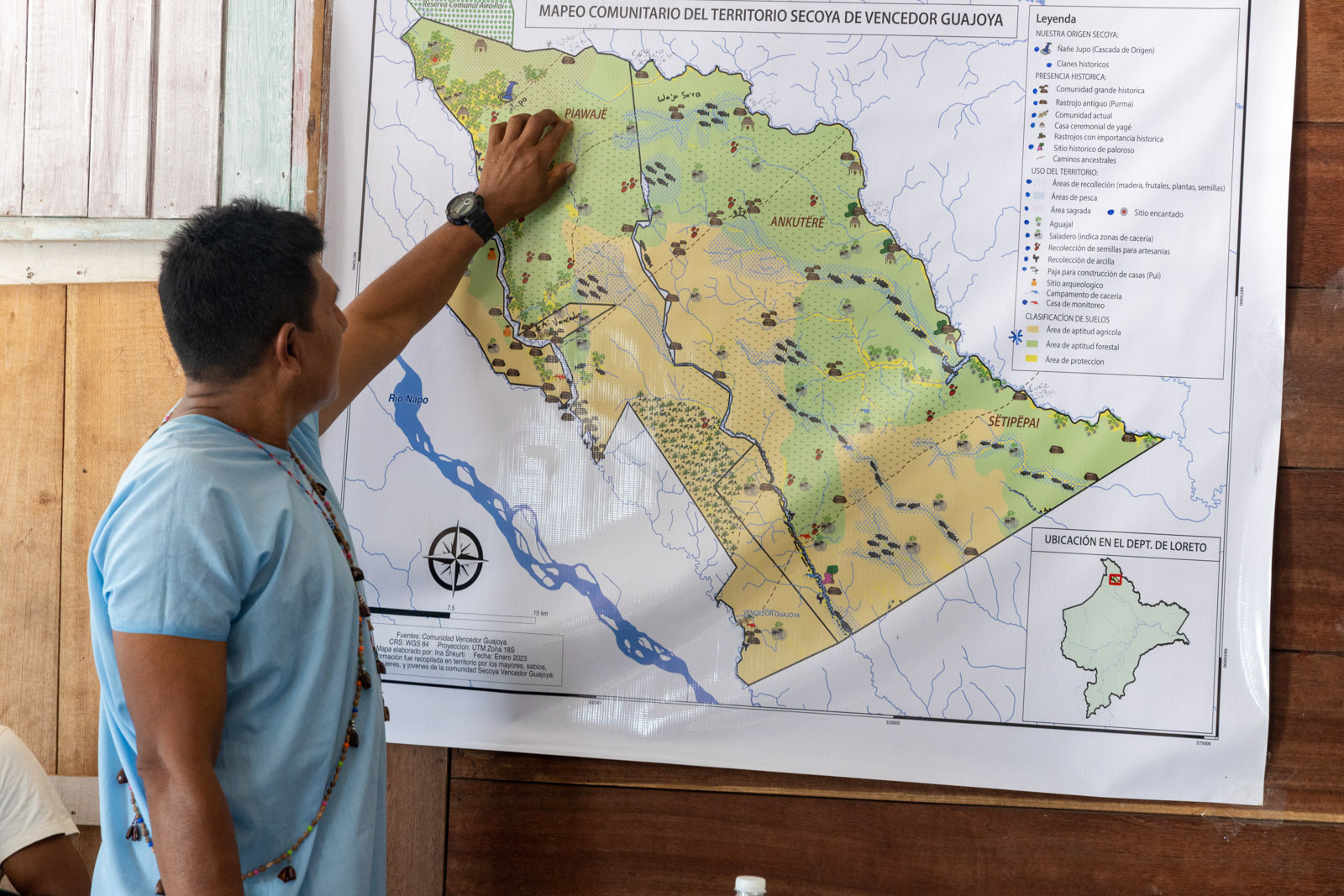
During my ten years working with Awana Digital, I have witnessed transformations as community members and Indigenous leaders recognize the power of communicating in a language comprehensible to courts and lawyers. Through mapping, they can represent their realities - perhaps not in their full array of dimensions or deep-time nuance, but in ways that can support today's imperatives: survival, respect for their fundamental rights, and guarantees for their children's future.
Joseph Oleshangay, a Maasai lawyer and advocate in Tanzania, has described how working with maps has transformed his approach to legal cases. By bringing together community evidence, conservation data, satellite imagery, and other forms of analysis, maps offer a wide range of possibilities for defending Indigenous rights.
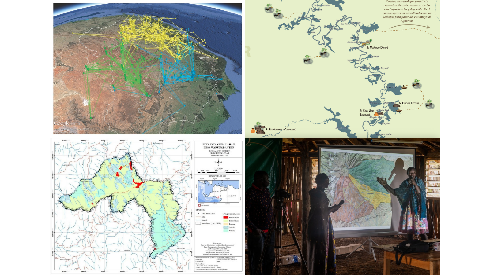
The report not only showcases the diverse purposes for which maps can be used in legal cases, but also delves into the how. How can communities carry out mapping and data collection in ways that support their use as evidence in court?
Drawing on experiences from the field, the report explores how to choose appropriate technologies for a community's needs, document Indigenous place names to demonstrate historical connections to territory, use printed maps and expert witnesses in court, and keep people and data safe when collecting sensitive information.
On November 5, Brian Parker and I will be joined by Phoebe Ndiema, an Ogiek leader who helped lead her community's mapping work on Mount Elgon, and Maria Espinosa, a lawyer with Amazon Frontlines who has worked with Indigenous communities to bring maps and other evidence into legal proceedings.
Moderated by Awana Digital's Executive Director, Emily Jacobi, the conversation will explore what these experiences reveal about the possibilities and challenges of using mapping to defend Indigenous rights and territories.
We hope you'll join us! Spanish interpretation will be available.
Register for the November 5 virtual launch
Kibet's song reminds us that relationships to land cannot be fully contained within the lines of a map or the language of a courtroom. They live in stories, songs, memories, and the knowledge carried across generations.
Mapping apps and digital representations cannot capture all of this. But in the hands of communities defending their territories, they can become other ways to make those relationships visible - and help ensure that communities can keep singing of their connection to and love for their territories.